Apr 12 2017
Microdrones, a global manufacturer of industry-leading unmanned aerial systems for surveying and mapping, recently forged a distribution agreement with Navigation Electronics, Inc. (NEI). Through this partnership, the team at NEI has added Microdrones mdMapper systems to their extensive product portfolio.
NEI sells and services mapping, GIS, surveying, and construction equipment from Trimble and other manufacturers to companies throughout the southeastern United States.
"We're very excited to be working with Microdrones and we've jumped in head first with their product offering," said Chad Hicks, NEI's Imaging Solutions Team Lead. "We're excited about the many benefits these UAVs can offer our customers. The aircraft have long flight times and the systems are very accurate and capable."
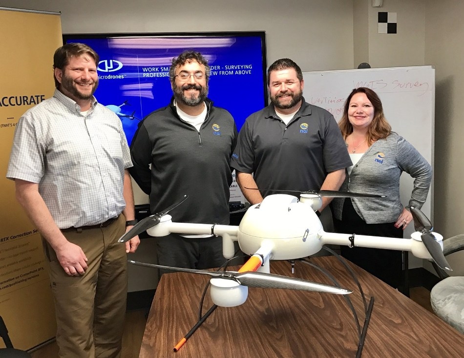
 From left to right: ¬Chuck Dorgan, Microdrones Sales Director for North America; William Poche, NEI Owner and Vice President of Sales; Chad Hicks, NEI Imaging Solutions Team Lead; and Angie Swirski, NEI MGIS Sales Manager. (Credit: Microdrones)
Available immediately, NEI is now offering Microdrones' mdMapper packages, complete solutions that integrate everything GIS professionals need for surveying and mapping applications. This product line-up includes:
- mdMapper200 – Compact, complete, and competitively priced, mdMapper200 is a great option for companies seeking the easiest possible drone to transport or a smaller drone to add to their fleet.
- mdMapper1000 – Extra-long flight times and resistance to harsh environmental conditions make this complete mapping system an excellent choice for applications like surveying, mapping, inspection, and construction.
- mdMapper1000DG – The benefits of mdMapper1000 plus the power of direct georeferencing combine to produce the best possible accuracy and time savings with no ground control points. This system was designed to enable highly efficient corridor mapping.
Microdrones mdMapper packages integrate the aircraft, sensors, and software users need to complete surveying and mapping projects more safely, accurately, and efficiently. They are also designed for simple training and easy use, so companies can get started quickly with aerial mapping.
Additional accessory bundles that integrate with these packages are also available, so users benefit from the flexibility and additional functionality of the platform. Some of these optional add-ons include inspection accessories, multispectral, thermal, and soon LiDAR and methane gas detection.
"One of the greatest advantages unmanned aircraft bring to the table for geospatial companies is an increase in the scope of work they can provide. Our clients' customers are asking them for UAV services and we're going to help them deliver it," said Hicks.
Prior to signing the agreement to become a Microdrones reseller, NEI sold Gatewing aircraft.
"Adding Microdrones quadcopters to our repertoire makes us a true turn-key geospatial distributor," explained William Poche, NEI Owner and Vice President of Sales. "Everything we do is about helping our customers to be successful. I want my clients to be able to offer even more for their customers and to be able to quickly and easily adapt to those customers' geospatial needs. Microdrones UAS will help them do that – and grow their business as a result."
Hicks agreed. "Not only do we have everything our customers could possibly need, we also provide the support to back it up. We don't just sell UAS. We support and train our customers to use them. We have dedicated resources for this and we are dedicated to helping our clients excel."
Microdrones will also assist NEI with training, sales, marketing, and product support as they get started selling Microdrones packages.
"We're excited to help NEI in any way that we can," said Chuck Dorgan, Microdrones Sales Director in North America. "They are a great company that cares about their customers. Together, we are going to help a lot of businesses to grow and succeed."
To find out more about the unmanned aerial solutions available through NEI, visit www.neigps.com.