Apr 8 2014
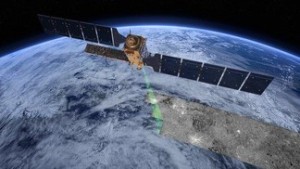
Sentinel-1, a satellite dedicated to gathering ultra-precise high-resolution images of our planet, taken day and night, was launched from Kourou on April 3rd as part of the ESA Copernicus program. Some swiss industries are involved in the project.
 © ESA/ATG medialab
Sentinel-1A was successfully launched on Thursday night from Kourou in French Guiana. This satellite is the first of ten to be launched as part of Copernicus, a joint program between the European Space Agency (ESA) and the European Commission. To date, this is the most ambitious program for the observation of Earth and environment monitoring.
This mission is groundbreaking in many ways. Designed to act in tandem, Sentinel 1A and Sentinel 1B – to be launched in 2015 – will orbit Earth diametrically opposite of each other, making it possible to fully image the planet in only six days.
Their state-of-the-art radar instruments are able to see through clouds and rain, and in darkness, providing images with a resolution of 10 m. Besides being able to rapidly transmit the data to several ground stations around the world, Sentinel-1 carries a laser to send data to the geostationary European Data Relay System for continual delivery. Thanks to all these features, the vessels will provide a day-and-night, ultra precise and high-resolution set of imagery of Earth’s surface and weather.
Multiple goals
The two satellites serve three different goals. First, they will monitor the oceans, continuously sampling the open sea, gathering information on wind, waves and currents, and measuring the changes in extent and thickness of Arctic sea-ice. These observations will help improve maritime navigation. They can also be used to track the paths of oil slicks and other pollutants and will be essential for a better understanding of the long-term impacts of climate change.
Sentinel-1’s second mission will be to monitor the land surface, a plus for agricultural practices, such as crop acreage estimations, soil moisture information, and harvest forecasts. By frequently flying over the same area, the satellites will also catch environmental threats, detecting even the smallest changes, allowing them, for example, to keep an eye on tropical forests.
Lastly, the Sentinels will bring new and precious aid to respond to emergency situations, such as storms, floods, earthquakes, landslides, oil spills, crashes, accidents, and all kinds of humanitarian crises.
Not all in one basket
“This mission is a continuation of Envysat, an enormous 8-ton satellite dedicated to Earth observation, which stopped functioning after a ten-year operation in space,” says Camille Pirat, scientific assistant at the Swiss Space Center. “The new Copernicus mission is interesting, because it uses a group of spaceships instead of one big vessel, thereby multiplying the viewpoints and collecting more data.”
Each new stage of the Copernicus program will be based on a constellation of two satellites. Sentinel-2 will deliver high-resolution optical images. Sentinel-3 will provide data for services relevant to the ocean and land. Sentinel-4 and Sentinel-5 will provide data on the composition of the atmosphere from geostationary and polar orbits, respectively.
Several swiss companies are involved in the development of the Sentinel-1 satellites, including RUAG Space, APCO Technologies, Syderal and Clemessy Switzerland, all of which are members of the Swiss Space Center.
Sources: European space Agency (ESA), Département fédéral de l’économie, de la formation et de la recherche (DEFR).
Author: Sarah Perrin
Source: Centre spatial