Aug 9 2017
A new research offers insight into ways through which cities and forests can be managed to cool planet Earth. Scientists at the Cornell University have employed drone technology to more precisely estimate surface reflectivity on the landscape—a technological progress that can provide an innovative technique for managing climate change.
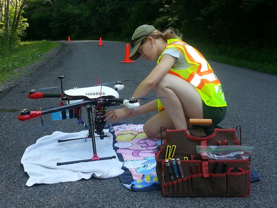
 Charlotte Levy examines a drone that will examine albedo before flight. Credit: Cornell University
“When making predictions about climate change, it’s critical that scientists understand how much energy the earth is absorbing and retaining,” stated Charlotte Levy, a doctoral candidate who gave a lecture on her study at the Ecological Society of America annual meeting on 8th August 2017, in Portland, Oregon.
Significant cooling, both local and global, occurs if solar energy is reflected by a surface and not absorbed. Albedo is the scientific expression for measuring surface reflectivity. “Albedo is important to understand because it’s one of the main controls for the Earth’s overall energy budget,” stated Levy, whose research project is headed by Timothy Fahey, Professor of Natural Resources. She works under the advice of Christine Goodale, a Professor of Ecology and Evolutionary Biology.
Levy and her colleagues employed drones (i.e. unmanned aerial vehicles) to develop an innovative technique for estimating albedo with higher flexibility and precision than could be done earlier.
For many years, climate Researchers have been able to obtain albedo estimates all over the United States by means of sensors and satellites positioned on research towers. Yet, only very few of the sensors and satellites exist. Moreover, it is not possible to move to compare the albedo of neighboring places.
The drones allow for measurements to be taken wherever they are needed. We can send one to hover above a forest and then have it fly across the road where the same forest was thinned five years earlier, and we can measure precisely what the difference is.
Charlotte Levy, Doctoral Candidate, Cornell University
Earlier efforts by Researchers to employ drones to analyze albedo have not been successful as the sensors needed to acquire the estimates are relatively hefty and interrupt the balance of the drones.
Levy and her colleagues reduced the weight, and consequently the engineering challenge, to nearly half. They achieved this by positioning just the downward-facing sensor on the drone. They positioned the upward-facing sensor in a neighboring field.
At present, the team is validating the technique, showing that the estimates obtained from the drones compare positively with the estimates obtained from the satellite and tower.
This is a big finding from a climate change perspective because we see a lot of potential applications.
Charlotte Levy, Doctoral Candidate, Cornell University
Hence the Scientists can gain insights especially into the impact of management methods on the overall albedo of forests. Consequently, they can regulate forest planning by including aspects that have an impact on climate change.
Over many years, climate Scientists have had a clear idea that planting of forests can have an overall positive impact on climate change. Yet under specific conditions, for example, areas covered with reflective snow for major part of the year, planting of trees may in fact lead to warming. In the cold regions, growing trees form a dark surface that absorbs energy. As the trees grow gradually, they are unable to absorb carbon like trees in warm regions, which grow relatively faster.
The main focus of Levy’s research is in ascertaining the places to plant forests in temperate regions with seasonal snowfall such that utmost positive effect on climate is ensured. Levy also analyzes complicated difficulties such as the manner in which thinning of forests corresponds to planting a specific species combination.
Albedo estimates for a particular land surface are as well crucial for global climate models used by researchers as a base for all climate predictions. The more precise and innumerable the estimates, the better will be the predictions. The drone technology can also prove to beneficial to Researchers and Architects who intend to measure the albedo of disparate styles of buildings—which will play a vital role in minimizing the urban heat island effect.
What we did is very simple. But it really changed how you can take these measurements, and we expect that to have a major impact on the way scientists think about global climate change.
Charlotte Levy, Doctoral Candidate, Cornell University