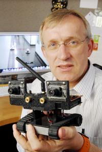
A team from the Georgia Institute of Technology, the California Institute of Technology/Jet Propulsion Laboratory (JPL), and the University of Pennsylvania has developed a robotic vehicle that performs a range of exploration activities and sends an elaborate floor map to humans.
The Director of the Robotics and Intelligent Machines Center and a professor in the Georgia Tech College of Computing, Henrik Christensen, stated that first responders could gain more insight if robots could perform a quick search about the structure and transmit a map.
 Robots with Mapping and Exploration Capabilities
The development of robotic vehicles that could explore and sends maps simultaneously is a major milestone in the Micro Autonomous Systems and Technology (MAST) Collaborative Technology Alliance Program funded by the U.S. Army Research Laboratory. The primary goal of MAST is to develop technologies that will facilitate small autonomous robots to aid humans during military and civilian operations performed in limited spaces.
During the experiment, the robots performed task of mapping by utilizing two types of sensors built into a video camera and a laser scanner. Integrated with onboard computing, the scanner measures walls and the camera detects windows and doors. The robot gains more stability due to an inertial measurement unit incorporated in it. The robot also sends data about its movement.
The robots develop a map of the local area by combining data from the sensors. Each robot uses a graph-based method called simultaneous localization and mapping (SLAM) for developing the map. The SLAM method enables an autonomous robotic vehicle to develop a map of both known and unknown surroundings. They are also capable of checking and reporting its present location. The team is currently working on a more complex experiment which will enable small autonomous aerial platforms to find a specific building and identify probable entry points and then call the mapping robots.