Feb 15 2021
In the past few decades, remote sensing technology has turned out to be a significant tool for researchers for tracking variations in ice cover, land use and vegetation worldwide.
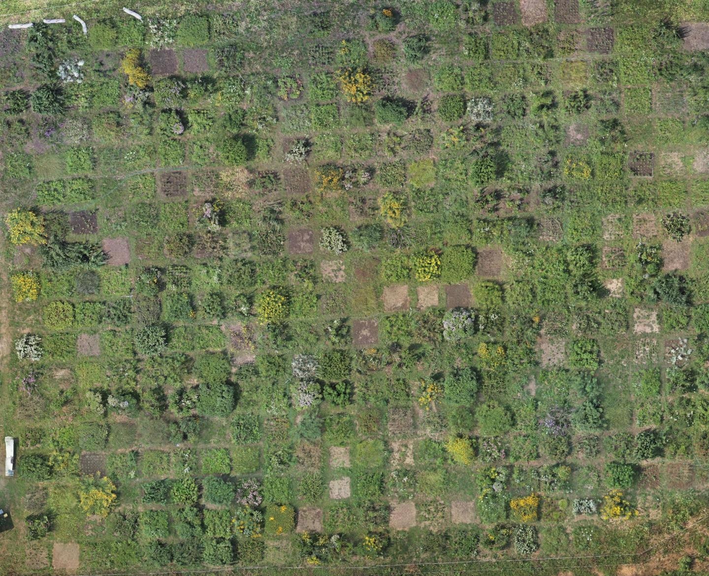
 The experimental tallgrass prairie at the Morton Arboretum from above. This orthomosaic is constructed from almost 600 overlapping drone images. Image Credit: Lane Scher.
But satellite imagery is generally available at merely rough resolutions, enabling the analysis of only broad trends across huge regions.
For investigators working at finer scales in agriculture and ecology, remote controlled drones provide an increasingly cheap alternative; however, the laser-based technology, such as light detection and ranging (LiDAR), used to estimate biomass and plant productivity, are still prohibitively costly.
In a study presented in a newly published issue of the Applications in Plant Sciences journal, scientists used a cost effective remote sensing technology to create multispectral vegetation indices as well as 3D photomosaics of the vegetation in a tallgrass prairie and then compared aerial estimates of biomass using measurements taken directly in the field.
Based on the researchers’ results, photogrammetry offers a consistent way to predict the productivity of biomass, ecosystem and landcover, with many possible cost saving implications for agricultural science and conservation.
At the Morton Arboretum based in Lisle, Illinois, scientists performed remote sensing data collection on a tallgrass prairie restoration experiment.
The restoration experiment is designed to determine whether or not phylogenetic diversity and functional diversity affect restoration outcomes.
Andrew Hipp, Study Senior Author and Plant Systematist and Herbarium Director, Morton Arboretum
To achieve this objective, Hipp and his group of researchers drew from a total of 127 prairie species, and each of these species was planted as a monoculture in plots measuring 4 m2.
The team also mixed these species in numerous combinations in multispecies plots of the same size, spanning from a low, medium and high phylogenetic diversity crossed with a low and high diversity of traits.
Lane Scher, the lead author of the study and a community ecologist at Duke University, envisaged the design of the experiment as a unique chance to verify the accuracy of photogrammetry-based estimations of biomass between multispecies and monocultures plots.
The investigators employed a DJI Phantom 4 drone fitted with a regular camera and also a multispectral sensor that would enable them to compute numerous vegetation indices—that is, metrics based on the ratios of light wavelengths indicating the relative productivity and health of plant ecosystems.
The researchers stitched together almost 600 overlapping images, and eventually produced a set of mosaics of the study site. This enabled them to estimate the height of the vegetation in every plot. Through extrapolation, the researchers were subsequently able to predict the overall biomass of the tallgrass species.
The team made analytical comparisons between the field-based and aerial-based measurements and these indicate that estimates of biomass obtained from photogrammetry accounted for up to 47% of the changes in biomass in the case of multispecies plots, a relatively important outcome that shows potential for this technique.
Of the metrics we used, volume was the best predictor of productivity, which is great news, because it's also the least expensive to measure.
Lane Scher, Study Lead Author and Community Ecologist, Duke University
While the team utilized a multispectral sensor to get imagery for varying wavelengths of light to estimate vegetation indices, their outcomes indicate that a simple RGB camera is more than sufficient to consistently estimate biomass.
But these techniques may not be as relevant to monocultures. The explanatory power of the researchers’ model, which was responsible for 47% of the variation in multispecies plots, decreased to 34% in monocultures—a trend that was not totally unexpected by the researchers.
“In monocultures, you typically have only one layer of vegetation,” Scher added. Plants belonging to the same variety and species usually have the same form of growth, with the result that the majority of the leaves vie for space in a single, packed layer.
In multispecies plots, however, vegetation can be more evenly spaced vertically.
Lane Scher, Study Lead Author and Community Ecologist, Duke University
Considering that 3D photogrammetry estimates volume as everything between the top layer of vegetation and the surface of the soil, plots in which plants are uniformly distributed in height will probably yield the most precise estimates.
While upcoming comparisons with analogous LiDAR measurements will be handy in further limiting the precision of photogrammetry for the estimation of biomass, the new research work provides a fast, simple and low cost technique to consistently assess the productivity of vegetation at fine-scale resolutions across massive study areas.
Journal Reference:
Scher, C. L., et al. (2020) Application of remote sensing technology to estimate productivity and assess phylogenetic heritability. Applications in Plant Sciences. doi.org/10.1002/aps3.11401.